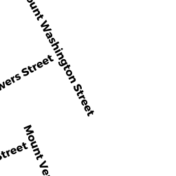
55 MT WASHINGTON ST
Owner Information
PONG KANG
55 MT WASHINGTON ST
LOWELL, MA 01854 3419


Property Details
55 MT WASHINGTON ST is classified as a Two-Family Residential (Two family).
The primary structure on this property was built in 1920. There are 5,927ft2 of built area within this property. There is 2,795ft2 of residential/living space within this property. This property is listed as having 10 rooms.
55 MT WASHINGTON ST is valued at $385,000. The land is valued at $68,800 and the structures are valued at $316,200.
This property is in Zone TMF. Confirm with local Zoning Board authorities to ensure there are no overlays or other easements on this property.
The most recent deed for 55 MT WASHINGTON ST is recorded at the local registrar in Book 27610, Page 0115. 55 MT WASHINGTON ST was last sold on Thursday, August 22, 2013 for $10.
Assessment data from fiscal year 2021.
Flood Data
According to the FEMA National Flood Hazard Layer, this property does not appear to be in a flood zone. It may also be in an area not yet reviewed. Nonetheless, confirm this information prior to taking any action.
To view the flood hazards around this property, create a FEMA "Firmette" Map of the area around 55 MT WASHINGTON ST.
Broadband Internet Providers
| Provider | Type | Bandwidth (mbps) | |
|---|---|---|---|
| Comcast | Cable | 1000 | 35 |
| Viasat Inc | Satellite | 100 | 3 |
| HughesNet | Satellite | 25 | 3 |
| GCI Communication Corp. | Satellite | 0 | 0 |
| T-Mobile | Fixed Wireless | 25 | 3 |
| Verizon New England Inc. | DSL | 15 | 1 |
| VSAT Systems, LLC. | Satellite | 2 | 1 |
| Crown Castle Fiber | Fiber | 0 | 0 |
Broadband service provider data from December 2020.
Adjacent Properties
- 61 MT WASHINGTON ST
Two-Family Residential owned by LI YAN - 103 BOWERS ST #1
Residential Condominium owned by TRS 60 MOUNT VERNON REALTY TRUST - 103 BOWERS ST #2
Residential Condominium owned by TRS 60 MOUNT VERNON REALTY TRUST - 103 BOWERS ST #3
Residential Condominium owned by TRS 60 MOUNT VERNON REALTY TRUST - 103 BOWERS ST #4
Residential Condominium owned by TRS 60 MOUNT VERNON REALTY TRUST - 103 BOWERS ST #5
Residential Condominium owned by TRS 60 MOUNT VERNON REALTY TRUST - 103 BOWERS ST #6
Residential Condominium owned by TRS 60 MOUNT VERNON REALTY TRUST - 103 BOWERS ST #7
Residential Condominium owned by TRS 60 MOUNT VERNON REALTY TRUST - 60-60 MT VERNON ST
Other, Open Space owned by TRS 60 MOUNT VERNON REALTY TRUST - 60 MT VERNON ST #2
Residential Condominium owned by TRS 60 MOUNT VERNON REALTY TRUST - 60 MT VERNON ST #3
Residential Condominium owned by TRS 60 MOUNT VERNON REALTY TRUST - 60 MT VERNON ST #4
Residential Condominium owned by TRS 60 MOUNT VERNON REALTY TRUST - 60 MT VERNON ST #5
Residential Condominium owned by TRS 60 MOUNT VERNON REALTY TRUST - 60 MT VERNON ST #1
Residential Condominium owned by TRS 60 MOUNT VERNON REALTY TRUST - 54 MT VERNON ST
Apartments with Four to Eight Units owned by PERRY JOANNE R - 51 MT WASHINGTON ST
Three-Family Residential owned by CHHUON CHEA